
Hiking the Mount Pinos Summit trail was 4 miles out and back. Located in the Los Padres National Forest, this trail was challenging during the first half while climbing up hill for 25-minutes in elevation. The air was thinner/lighter and I found myself huffing and puffing. My friend Melissa was much more conditioned and didn't seem to struggle up the mountain the way I did. All Trails considers this trail "Moderate" in difficulty. Here are some travel tips if you decide to visit Mount Pinos Summit, CA.
Mount Pinos Summit Travel Tips
Check Weather Conditions:
Weather at Mount Pinos Summit can change rapidly, so monitor forecasts and be prepared for sudden changes in temperature and visibility.
Dress in Layers:
Even in warmer months, temperatures at higher elevations can be cooler. Dress in layers to stay comfortable throughout your visit.
Bring Plenty of Water:
Hydration is key, especially at higher elevations. Carry an ample supply of water to stay hydrated during your hike or other activities.
Acclimatize to Altitude:
If traveling from lower elevations, take time to acclimate before exerting yourself at higher altitudes to avoid altitude sickness.
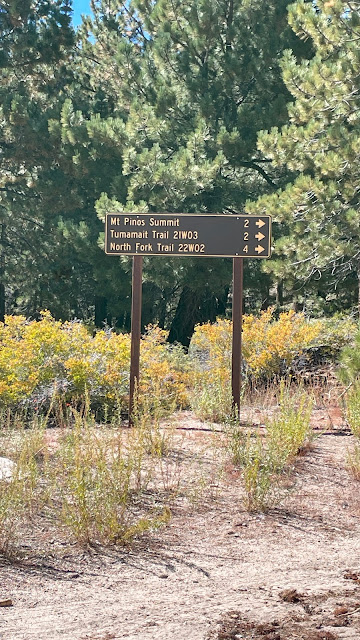
Know Trail Routes:
Familiarize yourself with trail routes and difficulty levels before setting out. Consider your fitness level and hiking experience when choosing a trail.
Pack Essentials:
Carry essentials such as sunscreen, a hat, snacks, a map, a compass or GPS device, a first aid kit, and emergency supplies.
Respect Nature:
Stay on designated trails, respect wildlife and vegetation, and follow Leave No Trace principles to preserve the natural beauty of Mount Pinos Summit.
Be Prepared for Snow:
During winter months, Mount Pinos Summit may be covered in snow. Bring appropriate gear such as snowshoes or traction devices if planning to hike in snowy conditions.
Check Road Conditions:
Road access to Mount Pinos Summit may be limited during winter due to snow or ice. Check road conditions and closures before your trip.
Enjoy the Views:
Once at the summit, take time to enjoy the panoramic views of the surrounding mountains and valleys, and capture memorable photographs of your experience.
Trip Recap:
Once half-way through the trail, it levels off and you get a short break and the trail feels somewhat flat as you make your way through meadows. The views are worth it at 8800 feet in elevation. The trail consists of half shade and half in the sun. An Adventure Pass or "America the Beautiful" pass is needed before heading to this trail. (I used the America the Beautiful National Parks annual pass since my brothers and I plan to visit some NPs soon).
For some reason, my friend Melissa and I had the entire summit to ourselves on October 5, 2023. We suspected it was likely due to the government shutdown or the fact that it was a quiet Thursday morning. Interesting contrast as the trail was crowded during the Covid pandemic back in 2020.


The photo doesn't do it justice. It doesn't look steep, yet it was and we used short bursts of energy to get up the hill.


The place was empty! We loved it.

What we learned at the summit (sign transcribed):
"Mount Pinos: A World in BalanceThe Chumash and other North American Indian groups saw themselves as part of the natural world rather than its masters.
Iwihinmu, Mt. Pinos, was the focal point of this balance. The Chumash call this summit Liyikshup, the center of the world.
Iwihinmu was created over 100 million years ago. From its 8,831 foot summit, you can see the Sespe, Dick Smith, San Rafael and Chumash Wilderness areas - lands preserved in balance forever.
On the slopes of Iwihinmu, a world in balance is reflected in the unique mix of subalpine, white fir, and Jeffrey pine habitats. Over 150 different plant species can be seen on this mountain including snowberry, lupine, gooseberry, and buckwheat. These trees and plants provide shelter and food for many wildlife species. From this summit, you may see species such as black bear, Lodgepole chipmunk, bobcat, mule deer, great-horned owl, and even the California Condor.
To the Chumash, Condor is "Almiyi", whose soaring flight represents the survival of the Chumah native culture.
The Condor has a nine foot wingspan and average weight of twenty pounds. The Condor can be seen soaring above large, open areas on Iwihinmu searching for carrion. The Chumash regard the California Condor as a sacred bird because it symbolizes the balance of power in all living things.
This sign is dedicated to the elders who have perpetuated the Chumash culture and have interpreted it for the rest of society."

Amazing views at 8800 feet elevation. It was kind of terrifying to see how high up we were and how easy it could be to trip and roll down the mountain.

Thanks to Melissa for this photo.


By the Numbers

It took us 4.48 miles on this hike.

We hiked for 2 hours and 41 minutes.
Elevation gain during the hike was 679 feet.


 Hey, I'm Christy Buena, a Filipina-American Los Angeles native and travel enthusiast. I love visiting new places and trying new food. Welcome to my adventure blog where I capture both State & National Park visits, family excursions, and road trips, while sharing my travel photos and recaps. My goal is to visit as many National Parks using my “America the Beautiful” annual pass.


0 Comments
Leave a comment. Don't be a jerk. Thanks!